Paris-Lille-3D

Password is: Paris-Lille-3D
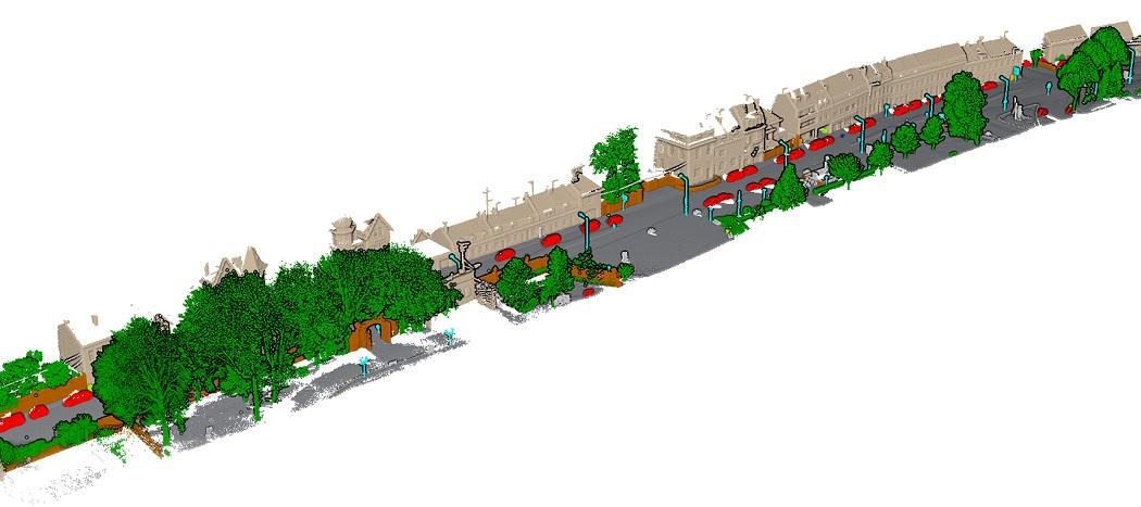
The Paris-Lille-3D is a Dataset and a Benchmark on Point Cloud Classification. The data has been produced by a Mobile Laser System (MLS) in two different cities in France (Paris and Lille).
The Point Cloud has been labeled entirely by hand with 50 different classes to help the research community on automatic point cloud segmentation and classification algorithms.
You can find all the details on the training dataset in the following article:
Roynard X., Deschaud J.-E., Goulette F., Paris-Lille-3D: a large and high-quality ground truth urban point cloud dataset for automatic segmentation and classification
We release a test dataset to submit your classification results on this ranking page. The evaluation is based on 10 coarse classes. So we transformed the training files to keep only the 10 most represented classes.
The details for submitting new results are available in the "readme.txt" file accompanying the dataset.
If you use this dataset, do not forget to cite our article:
@article{roynard2017parislille3d,author = {Xavier Roynard and Jean-Emmanuel Deschaud and François Goulette},title ={Paris-Lille-3D: A large and high-quality ground-truth urban point cloud dataset for automatic segmentation and classification},journal = {The International Journal of Robotics Research},volume = {37},number = {6},pages = {545-557},year = {2018},doi = {10.1177/0278364918767506}}
Paris-Lille-3D dataset is made available under the Creative Commons Attribution Non-Commercial No Derivatives (CC-BY-NC-ND-3.0) License.
| Name | Av. IoU | Ground | Building | Pole | Bollard | Trash can | Barrier | Pedestrian | Car | Natural |
|---|

